Tuesday, December 30, 2014

THE BATHS

0900 hours, December 27, 2014, North Sound Virgin Gorda, BVI: The ferry pulls away from the dock at Bitter End heading for Gun Creek. Gun Creek is the connection for the resorts in North Sound with the local community, and transportation to southern part of the Island. The Bitter End Ferry runs back and forth hourly transporting resort workers, and resort guests connecting to other islands through ferry service from Spanish Town, or as we were, exploring the remainder of the Island. Jackie makes friends easily. By the time we docked at Gun Creek, ten minutes after our departure, she was on a first name basis with everyone. 

We had arranged for a rental car a couple of days earlier. We were meet in Gun Creek and driven back to the rental car yard in Spanish Town, on the flat southern part of Virgin Gorda. From Gun Creek to Spanish Town the road climbs up nearly to the top of Gorda Peak with its 1348 foot summit. Most of the drive is through the Gorda Peak National Park. What tremendous views. As we climbed toward the Peak we could look back down into North Sound with Sir Richard Branson's Necker Island beyond. Just past the Peak we could look across the Sombrero Passage with the Atlantic Ocean to the north and the Caribbean Sea to the South, toward the Leeward Islands. From here we could see several peaks in the distance which probably included Saint Martin with its 411 foot peak, perhaps Saint Barthélemy with its 286 foot peak and further south, Saba with its 514 foot peak and Saint Kitts with its 1156 foot peak.  As we descended on the south side of Gorda Peak we could see the southern section of Virgin Gorda. To the west we looked down the length of the Sir Francis Drake Channel, with the British Virgin Islands on either side, and St Johns and the American Virgin Islands at the west end. 

Although our car rental would have been worth it just for the fantastic views, our destination today was the Baths. The Baths were created by the Islands volcanic origins which deposited giant granite boulders intermixed with softer material that eroded through the years leaving piles of these boulders on the beach. These piles create tidal pools, tunnels, caves,and arches open to the sea. The Baths can be entered by hiking down trails from the road, as we did, or from the mooring field just off shore. As they won't let you bring dinghies ashore, if you arrive by boat, you must swim to the beach. 

The National Park Service has built wood stairs and provided rope hand rails to assist in climbing through a path between and through the tidal pools, tunnels and caves the pile of giant granite boulders provide. Following the path Jackie was greeted again and again by friends she had made on the Ferry ride to Gun Creek. After climbing through the Baths we stopped at the main beach for a swim.  Seemed like everyone in the water knew Jackie. She would swim from one to the next as they called her name. She then swam out to a snorkeler who thought, when he saw her approaching underwater through his mask, that he had discovered a strange new sea creature.  He had. 

We then sat on the beach with the water lapping at our feet, and Jackie between us, soaking in the sun. It felt so good we didn't want to leave. 


Monday, December 29, 2014

CHRISTMAS IN THE NORTH SOUND

1815 hours, December 25, 2014, North Sound Virgin Gorda, BVI: arrived by dingy at the Caribbean Outpost of the Italian Yacht Club Costa Smeralda, for Christmas dinner. The Yacht Club Costa Smeralda was founded in In 1967 at Porto Cervo in Northern Sardinia. The club was an Americas Cup contender twice and yearly sponsors several international regattas including the warm up to the St Barths Super Yacht Bucket Regatta.  The Club's facilities in North Sound, with its super yacht marina, were completed in 2012, and are exquisite.

We warmed up to Christmas watching a Christmas Eve Boat Parade through the moored and anchored boats in North Sound, and our lighted Christmas Tree in our Salon. Earlier in the day on Christmas eve, we took a picture of Jackie from the Bitter End Docks with a santa's hat which we emailed to friends and family. Santa brought Jackie a ginger man for Christmas which she carried around all day displaying her appreciation.

The Yacht Club's dinning room is at the top of the Club House on a terrace overlooking an infinity pool a half level below. We were early and were escorted to a front row table just above the pool. From here we were looking back, and down, at Bitter End, and over the entire north half of the North Sound anchorage with many of the boats lighted for Christmas. The view and accommodations were fantastic. 


Sunday, December 28, 2014

BITTER END YACHT CLUB

0830 hours, December 24, 2014, North Sound Virgin Gorda BVI: We took the dingy ashore to explore Bitter End. The Yacht Club's facilities stretch along and climb up steep Biras Hill behind which forms a peninsula with Bitter End occupying the north and east edges. About two thirds of the Yacht Club's facilities face North Sound to the east, and about a third face Eustatia Sound to the North. Along the shore is a series of individual beaches with palm trees, manicured mangroves, cushioned lounges, hammock,  thatched shade structures and a pool. Between the beaches on the North Sound side are several Marina piers, a fuel dock, restaurants and structures supporting every imaginable water sport. Immediately behind the beaches is a mostly concrete brick paved path separating the beach from natural weathered wood cottages with cantilevered balconies surrounded by natural growth, stepping up the Hill. Between the cottages and the brick path is a well groomed landscape with red, white, purple and magenta bougainvilleas and pink oleanders along with a varity of other plants. 

Behind the path on the hill side of the Marina and water sports area is a another restaurant, an emporium, gift shops and a sailing school, all in separate buildings. Walking on this section of the concrete brick paved path, you feel like you are in a New England seaside village. 

Eustatia Sound is formed by virgin Gorda to the south, the east end of Prickly Pear Island  and Eustatia Island to the west, and Eustatia Reef to the north east. The Reef stops the ocean swell but is open to the east and north east prevailing winds creating a perfect area for wind surfing and kiting. The Reef is also excellent for snorkeling and scuba diving as are many other reefs in the area. For the sailor Bitter End Yacht Club rents Hobie Cats, a varity of small monohulls, larger monohulls in the 30 ft range, and small whalers for the power boaters and fisherman. They also rent kayaks and paddle boards. Their sailing school has several programs for those who want to learn to sail or improve their skills. 

In all, a paradise for those who love boating and water sports. 


Friday, December 26, 2014

NORTH SOUND

1330 hours, December 23, 2014, North Sound Virgin Gorda, British Virgin Islands: Picked up a Bitter End Yacht Club mooring, next to Chance, a boat that had also summered in Brunswick Georgia for two of the three seasons we were their. We had only meet the Owners once in Brunswick, they are also from Southern California. As it turned out they had arrived 20 minutes before us, and had taken advantage of the same weather window we had coming south. This was their third season and they generously shared a lot of information with us about North Sound. 

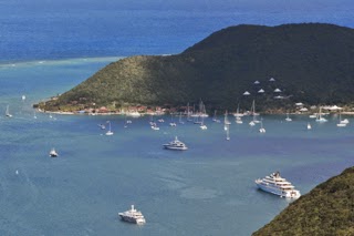
North Sound is formed by Virgin Gorda on one side and Mosquito Island, Colquhoun Reef, Cactus Reef, Prickly Pear Island and Saba Rock. In this Sound, that is protected from seas in any direction, Sir Francis Drake and Sir John Hawkins prepared their forces before heading into the battle of San Juan where Hawkins died and Drake was defeated. Sir Richard Branson recently bought Mosquito Island where he is planning to build an exclusive resort. Sir Richard also owns Necter Island, just north of North Sound, where he built an Bali- esque home for his own use. Prickly Pear Island is a nature refuge, and a habitat of the prickly pear cactus. Saba Rock is almost entirely covered with buildings which include 2 bars, a restaurant, a hotel, slips and a large dingy dock. 

There are several resorts, marinas and clubs all within fast dingy distance within the Sound. The best known and largest is the Bitter End Yacht Club. The Club sits on a Virgin Gorda peninsula at the north end do the Sound. Moving clockwise: is the Biras Creek Resort with a stone Castle Restaurant with views of the Sound and the Caribbean; Biras Creek Marina with its Fat Virgin's Cafe ( the name Columbus had for the Island as the Island looked to him to be a fat virgin lying on her side from a distance); the out post of the Italian Yacht Club Costa Smeralda, with its super yacht marina and grand scaled club house and exclusive restaurant, Gun Creek, a local town with the Immigration Office and several local restaurants; Leverick Bay with its marina, mooring field, restaurants, Small Resort, and grocery store; Drakes Anchorage on Mosquito Island, with a small mooring field Resort and Restaurant; Sand Box Seafood Grill and Bar with its mooring field on Prickly Pear Island; and Saba Rock Resort (discussed above) complete the clockwise loop. 

We found the Sound filled with a number of super yachts to 300 feet plus, both power and sail, small cruise ships (as many as three at a time), and hundreds of smaller boats, mostly all sail. 


Thursday, December 25, 2014

CANEEL BAY

0800 hours, December 23, 2014, Caneel Bay St John's Island, USVI: We raised anchor and headed east. Our 5 day stop at Sapphire Beach Marina on St Thomas had been to clean the boat and re provision. We left on December 22,  with our first stop Caneel Bay just across Pillsbury Sound. This was special, as it was our first stop on our honeymoon 42 years earlier on a bare boat charter out of Red Hook (next door to Sapphire Beach).  My Father's pictures and stories of his stay at Caneel Bay 10 years before our honeymoon had been part of the inspiration to bare boat in this location. 

The beauty of St Johns so impressed Laurance Rockefeller, and he bought most of the Island.  The 170 acre Caneel Bay Resort was subsequently built with its main buildings on the site of old sugar mill, and added to his chain of resorts. The original site planning concept, which remains today, was to blend into the environment with one and a few two story buildings set back between palms and well trimmed mangroves along the Resort's fantastic beaches with acres of rolling lawns in clearings between. The tree lined beaches with manicured green grass behind white power sand and aqua colored water, include all the elements of the perfect beach.  And, the Resort has seven. Rockefeller then donated the remaining portion of the Island he owned as a national park which curround, and separates the Caneel Bay Resort from the remainder of the Island. 

After anchoring we went ashore to pick up friends to join us for sunset aboard. The Resort was every bit of what we had remembered from 42 years earlier. 

With our travels up and down the East Coast, and through the Bahamas the last four years we had not anchored in deep water for several years.  At Caneel Bay we were anchoring in 60 feet of water plus 10 for freeboard is 350 feet of chain. With our 64 foot boat that  is a 400 foot radius. It took us a couple of try's with changing wind strength and currents to realize that wind and current could not be counted on to keep us aligned with others. With a 400 foot radius we  simply could not anchor close to any one. 

Forty years ago they didn't have near the  inter island ferries and passenger vessels they have today. There are a lot, and they all seamed to be on a route past Caneel Bay leaving us their wake on our beam to roll in. Fortunately we had our stabilizer system which we deployed to dampen the wake driven rolling.


Sunday, December 21, 2014

LAST LEG ON OUR CARIBBEAN PASSAGE

0630 hours, December 17, 2014, Palmas Del Mar, Puerto Rico: Left the Marina and headed north east between Puerto Rico and Isla Vieques toward what was Roosevelt Roads. 
Roosevelt Roads was a major naval base built in WWII with the capacity of harboring the entire U.S. Atlantic Fleet, if necessary. Greg was stationed their for 9 months in the 1970s, looking out at Vieques every day. Vieques was a bombing range at that time and off limits to even Navy personnel. We look forward to exploring the Spanish Virgin Islands on our return trip, our goal today is St Thomas in the U. S. Virgin Islands. After turning east by Roosevelt Roads our trip was only 45 nm to the east end of St Thomas. Seas were 2 to 4 from the ENE and winds here under 12 knots, and best of all, it was sunny. 

We had decided we wanted to stay a couple of days in a marina to clean up the boat, restock and prepare for island hopping. Looking at the cruising guides and Active Captain, none of the marinas in Charlotte Amalie or Red Hook sounded appealing. The only one we found that appeared to be quiet and out of the hustle, was Sapphire Bay Marina. We had called two todays before to find out that they did have a slip but its width was only 18 feet. Our beam is 17' 8", a little too tight.  After discussions back and forth over the next day the dock master went to the condominium association to get permission for us to use their old fuel dock which they were no longer using to sell fuel. He had notified us the day before he had received permission. 

As we passed Charlotte Amalie we counted 5 cruise ships and were thankful we had a slip in a more peaceful marina. On entering Sapphire Marina the dock master met us by dingy to guide us in and help if necessary, make the hard right turn we and to make just inside the Marina. What a perfect spot. We are the last boat in the Marina next to the entry jetty. We face Pillsbury Sound looking directly at Caneel Bay on St Johns Island out our starboard pilot house windows. Although the project is old and in need or repair, the docks in our area of the Marina are new. This was the perfect place to unwind from our 10 day passage from Florida. 


SOUTH SIDE OF PUERTO RICO

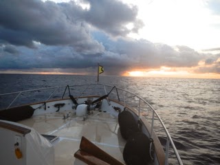
0630, December 16, 2014, Puerto Real, Puerto Rico: Marina Pescaderia had allowed us to stay overnight on the fuel dock. We left the dock at first light heading south around Cabo Rojo, and then east to the east end of the island. The sunny weather we had the previous day was like we had punched through the front. Last night the front caught up with us and a massive cloud formation hung over the island with the sun rising at the other end of the Island in a narrow horizontal slot between the land and the clouds, turning the bottom of the clouds red. 

Fortunately the seas were again 2 to 4 feet as they were directly on our nose as we headed east. Today we would  pass by the edge of several squalls, and run through another. After rounding Cabo Rojo the winds increased to 10 to 15 knots and later in the day they increased  to 15 to 20.  Jackie, our golden doodle, did as she had done on the last several days laying on cushions on our bed with the air conditioner running  when we would turn on the generator to charge our inverter batteries. The trips she would periodically make up to the pilot house  we first thought was to remind us she was still with us, but then realized it was to tell us to turn the air conditioning back on. Needless to say, she weathered the trip in far more comfort then we did sleeping between watches on the pilot house settee. 

The trip was 100 nm. Our destination on the east end of the Island. With no good anchorages available in the immediate area we choose the Marina Palmas Del Mar. The reviews of the marina were good, but primarily based on the responsiveness of its staff. The marina staff was very helpful. In addition to helping us tie up they assisted in removing a crab trap line with black styrofoam buoys that was caught in our starboard stabilizer fin.  This was our first after over 10,000 nm which included many crap trap mind fields.  Although the staff was outstanding the Marina design was terrible. The piers were poured in place concrete with no fenders, bumpers or dock edging protection. The piers and fingers were fixed, which is ok with the 6 inch tide variation, but they were too high, and there were too few cleats. Because of the height of the piers and the location of the few cleats they did have, the dock lines rubbed over the edge of the dock, and would cause chaffing in short time with the surge that I am sure is almost always present in the Marina with its entrance directly exposed to prevailing conditions.  We have rub rails, as many trawlers do, which protect the sides of the boat in situations where fenders don't with vertical wood piling. Here the bottom of the horizontal concrete dock was above our rub rails leaving our hull completely exposed.  Apparently recognizing this defect the Marina staff brought large fenders with them to assist our docking. However with inadequate number of cleats they were limited in where they could place the fenders.  The developers spent a lot of money on this relative new Marina and condominium project. A proper dock design could not have cost much more. 


STRAIGHT THROUGH TO PUERTO RICO

0400 hours, December 14, 2014, Cockburn Harbour, Cacios Island, Turks and Caicos: With the Harbour entrance markers lighted it was easy to make our way out of the Harbour and on our course south going over the Bank just south west of Great Sand Cay and east of Endymion Reef. We continued on this course until we reached the south west corner of Mouchoir Bank. From this point we headed south east that put us on a course that just missed the south west corner of Silver Bank. Both Banks raise from the ocean floor of from 2,000 to 13,000 plus feet to 50 or so feet below the surface. This dramatic difference in depth can result  significantly rougher seas over the banks. This course put us on a direct heading for Isla Desechero, a small island about 10 nm off Puerto Rico at the north east  side of Mona Passage

As with the last to days we had caught up with the back end of the front we had waited until it passed anchored in George Town on December 10th. The trip started with the relatively mild weather we had experienced the last two days. As we approached late afternoon on December 14th we were off the south side of Silver Bank with the wind piping to 22 knots and the seas building to 6 feet. As with the last two days it had been overcast all day with some rain. Although we saw squalls in the distance we had not directly past through any. With concern it might get worse we called Chris Parker to check in. Chris reminded us, as he had previously told us, that we could experience winds to 25 knots in squalls. Chris stated we had caught up with the front and there had been a number of squalls in the area. He did not think it would get worst. Before midnight the wind had slowed to 15 knots, and by 0300 on the 15th, the seas were back to 2 to 4 feet. Winds dropped further to 10 knots in late morning as we approached Isla Desechero with the first sun we had seen in three days. 

As we approached  Puerto Rico with the sun shining a group of sea birds circled our boat as if they had flown out to greet us we were ending our longest passage. We soon realized the birds had not come to greet us but to feed on the flying fish that became airborne from our bow wake. Based on reviews from Active Captain we decided to fuel at Marina Pescaderia in Puerto Real, a small almost completely enclosed bay just north of Boqueron on the south east end of Puerto Rico. Upon calling them we got our second greeting to the tropics, diesel at $3.43 a gallon! On the way down we had considered topping off at Blue Haven Marina on Caicos island. Blue Haven's fuel was over $7.00 a gallon. 

Our original plan was to leave Florida in early November where historically there is a higher probably of good weather. Unfortunately we couldn't due to changed business commitments. Leaving late as we did we had expected we would be stuck in more than one port waiting perhaps weeks for good weather. With Chris Parker's continuing predictions of mild weather we just keep going and were glad we had now made it to Puerto Rico and across the infamous Mona Channel in good weather. Further with the ENE winds and hugging the Banks tightly we were able to reach Puerto Rico with the seas on our port forward quarter, far more comfortable than having to head directly into the sea which is normally what you are forced to do along the coast of the Dominican Republic. 


Saturday, December 20, 2014

Calm Night in Cockburn Harbour

0430 hours, December 13, 2014, Start Bay Mayaguana, Bahamas: Raised anchor and headed to the south west corner of West Caicos. From this bearing point we would head further south east to a point between French Cay and West Sand Spit where we would enter the Caicos Bank. Once we were on the Bank we followed the magenta line on the Navionics Chart to the west edge of the bank just south of Long Cay. The magenta line navigated us safely through the coral heads that are located through out the Bank. Winds were In the 10 to 15 knot range seas were 2 to 4 off the Bank,  and less than 2 on the Bank, and the seas were ENE as we ran this 115 nm course which included a final 3 nm leg north to Cockburn Harbour. 

The night at Mayaguana had been similar to the night before at Rum Cay, light wind and rolling. We were again the only ones in the Harbour and again our security alarm went off this time just after midnight. We had used the alarm every night on the trip and these were the only two nights it went off. There were other boats in the Harbour when we arrived in Cockburn Harbour. We had a peaceful night with no rolling and no alarm. This was just what we need to prepare us for the 325 nm straight through run to the west end of Puerto Rico we would start on the next morning. 

Our New GOST Security System

0400 hours December 12, 2014, Rum Cay: raised anchor and set course for Mayaguana, 125 nm to the south east.  Although the night had been calm with winds under 10 knots, there was an uncomfortable surge on our beam. This gave us an opportunity to to use the stabilizer system we had installed for this situation, with two 11 foot spinnaker poles and two Magma stainless steel folding plate stabilizers. These don't stop the roll but significantly dampen it. 

Having read the PassageMaker article about security in the Caribbean last summer and having set through a session conducted by the same author at the October Trawler Fest, it was clear we needed to take some precautions. Our goal is always to do everything we can to prevent an adverse incident.  To this end we had a security system installed with deck sensors that set off deafening sirens and flashing lights as soon as anyone stepped on the boat. With the high rate of dingy theft in the Caribbean we also installed the deck sensors in our large dingy. As a further precaution we changed our deck lights to LEDs and put some of them on a photocells. We also installed a worldwide satellite tracking system to track the vessel if it were stolen, and added high water and low power sensors that would remotely notify us of any problems. The GOST System (Global Ocean Security technologies) was the only system we found that was designed for our specific needs. 

Before going to sleep as the only boat anchored in the bay at Port Nelson on Rum Cay the night before, we set the security alarm.  At 0200 hours on the morning of the 12th the alarm went off. By the time we could get to the salon to look through windows at our lighted decks, there was no one their. Out of precaution we waited a few minutes before unlocking the doors and venturing to the railing to search the water for anyone. We could find nothing but were comforted by the fact that the system had been successful in chasing what ever it was away. 

Like the day before Buoy Weather's predictions of over two meters of sea was wrong, and Chris Parker's predictions of 2 to 4 foot seas were correct. We arrived at our destination of Start Bay on the south west side of Mayguana island just as the sun set. We had chosen this location based on Stephen Pavlidis' recommendations  that  this was a good stopping point with easy departure in the morning dark. 
PLANNING FOR THE JOURNEY PATH AHEAD


0830 Dec 11, 2014 GeorgeTown Exumas:  Raised anchor and headed to the south end of Elizabeth Harbour.  Unlike the harbour to the north, the Navionics Charts had a magenta line and two sets of markers marked the channel  between shallow areas and coral heads. Then when the navigation challenges increased as we approached the south entry with coral heads and reefs on both sides, the magenta line and markers disappeared leaving us to fend for ourselves.  Fortunately the Explorer Chartbook we had purchased at the Trawler Fest had waypoints.  However, some of these waypoints ran over Navionics located coral heads.  From reading the water it appeared that Navionics location of the coral heads and reefs were right on.  Not knowing the depth of the heads we steered off the Explorer Chartbook waypoint course to miss the heads.

We had stayed at anchor the day before, with the passing front, studying every possible route south we could imagine.  Google Earth is great for calculating distance of paths giving the answer directly in nautical miles.  Bouy Weather’s seven day forecast is also great for looking at the predicted weather at exact points along the route.  I like the detail in Stephen Pavlidis Cruising Guides as well.  We are also using Chris Parker on this trip.  I have been doing my planning using the above guides and then discussing the plan with Chris. Twice now the conditions predicted by Bouy Weather as being borderline passable were in fact mild as Chris Parker predicted.  To date Chris Parker has been right on.  The passage to Rum Cay today was an example.  Bouy Weather has predicted seas to 2.2 meters.  The ground swell was less than four feet, and winds were mild as Chris Parker had predicted.


As the Navionics charts for the Northern Bahamas run out at GeorgeTown we switched to the Caribbean Charts.  We are using the platnium charts for the Caribbean.  I was surprised to find that the chart did not have much detail for the Dominican Rebublic.  One of our possible stops was Ocean World on the North Coast of the Dominican Republic.  Although the Navionics Charts show the Marina they show no detail.  Fortunately we have other books aboard with detail

Wednesday, December 10, 2014

EXUMA SOUND TO GEORGETOWN

0600 December 9, 2014 Black Point Exumas. We raised anchor and headed through Dotham Cut into Exuma Sound for a 50nm trip to Georgetown. Winds were from the west at 10 knots and we were in a flood condition passing through the cut with a 4 to 5 foot inbound swell breaking on the rocks on each side of the cut. The passage was uncomfortable and my guess unpassable with the incoming tide and west winds with greater strength. After reading the reviews in Active Captain we decided to stop for fuel at the Emerald Bay Resort north of Georgetown. As reported it was a very nice relatively new marina with floating docks. Challenge was getting in and out with a 5 foot ENE swell, and a dog leg entrance to protect it from the east and south east prevailing conditions.  Our 1600 caterpillar horses made this entrance and exit easier.

We entered Elizabeth Harbour at Conch Cay Cut, again with the 5 foot ENE swell rolling directly into the Cut. Although sticks have replaced the navigational markers, marking the immediate left turn once inside the Cut, they were at least there. On the rest of the harbour to GeorgeTown we were left to read the bottom ahead based on the color of the water, our Navionics electronics charts and the latest version of the Explorer Chartbooks we had just purchased at the October Trawler Fest in Baltimore.  We use all three.


THE CHUB CAY RESORT

0430 hours, December 8, 2014, Chub Cay

Hoisted anchor and headed east in the Northwest channel on a course to Nassau on New Providence Island, 35NM away, wind around 10 knots swell ENE, on our beam 3 to 5 feet, at 10 seconds.  After anchoring the night before we ventured by dinghy into the marina. Unlike what we had read, everyone was friendly. No landing fees or fees for Jackie (our miniature golden doodle).
The Marina and the current Resort at Chub Cay, which is called the Chub Bay Club, was developed by three Florida businessmen, one of a construction manager, one a attorney and the third a boating promoter who had been behind organizing the Fort Lauderdale boat show. The initial phase which included the marinas and other amenities was completed just before the crash. The three did not have the staying power and the bank took over.

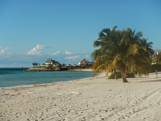
Chub Cay is known for its great fishing. Sitting on the edge of the Bank, you can start offshore fishing almost immediately after leaving the marina. To the north of the Cay are nearly a thousand acres of shallows with filled with bonefish. The Cay also has a number of beautiful white sanded beaches. The island sits 125 miles from Miami, 130 from Fort Lauderdale and 140 from Palm Beach, an easy days runs for hundreds of big carolina style fishing boats that homeport in these locations. The concept, create a world class fishing resort. Although it's not finished what is, looks good from a architectural standpoint.

What happened?  A major project like this takes years in the planning and execution. Significant staying power is required to ride out the inevitable down run that will almost always hit a project of this site at some point. The three obviously didn't have it or were in a position where they could walk away.  The second failure appears that their plan required returns from residential real estate sales needed to substain the project and make a profit.   The last time I looked, most big carolina style fishing boats are not short or great accommodations.  I don't think many of these folks are looking for stationary second homes.
We hope someone figures how to make the development work.  It's a beautiful place to visit.


BEAUTIFUL DAY ON THE BANK

1430 hours December 7, 2014, Chub Cay

Dropped anchor just off the beach at Chub Cay Club House, winds ENE at 12 knots.  Crossing the Bank to North West Channel seas were 1 to 2 feet and winds below 10 knots from the ENE.  The day was sunny with a mild breeze on the flybridge where we spent most of the day listening to CD's, including Kenny G's Holidays.  Breaking in the new systems we had added for the trip on top of our fuel leak had been frustrating.  It was great to finally be on our way in great weather, Kenny G's Holiday CD was the icing.  Unlike our busy night in the stream we saw only a hand full of boats on the Bank.


SECOND TRY

22:00 hours, Saturday Dec 6, 2014

Lake Worth, Florida pulled anchor and headed east through Lake North inlet toward our first way point, between Chicken Hens and Great Isaal on the North West corner of the Great Bahama Bank.  A 67nm distance.  Moon full, wind less than 10 knots with a two to three foot ENE swell aft our beam.  Could not ask for better conditions.

This would be our second try at starting our Carribean cruise.  Two weeks earlier on our way to Bimini we found a leak in the port engine return fuel line from the fuel cooler filling our bilge with diesel.  We continued on one engine to Bimini thinking we could easily get "rubber hose" replaced in this popular spot.  We spent the night exploring our options.  As the hose was not a standard part and required a special made fitting we would have to take it off send it to Florida or Freeport to have a new hose made a process that would take at least a week.  As we also had problems with a new Simrad NSE-12 screen that had just been installed and had not yet worked out all of the programming issues on our new GOST security system, we decided to head back to Florida the next day, on one engine.  This was the last passable day in this weather window.  Saturday, December 6th the day we left, was the next.

CROSSING THE STREAM

0615 hours, Sunday Dec 7, 2014, Great Bahama Bank.  We passed between Great Isacca with it's unlit lighthouse and Hens and Chicken two small islands at the north west corner of the Great Bahama Bank.  It was a busy crossing during the night we saw at least 40 AIS markers most all ships heading north or south. One, a Carnival Cruise Liner had to be contacted by radio, who reluctantly  changed course to avoid a collision with us.  We had the right of way and we were maintaining course and speed as required.  In a second close encounter with a large cargo ship where we were burdened and to changed course.   A third near encounter occurred when we passed very close to a 150' super yacht towing a 30' tender a couple of hundred yards or more behind.  Although the tender was lit  the super yacht did not carry the two mast head lights required which provide warning of a towed vessel behind.  After carefully studying the movement of the radar signals for both vessels we concluded the second one was being towed.

Chub Cay to Black Point

0500, December 8, 2014 in route to Nassau.  A ship with no lights, except minimal required running lights, and no AIS signal appeared on our starboard beam and silently slip across our bow going at least 20 knots (we were traveling at 10 knots) as the night photo shows it had forward guns and the silhouette of a US Navy ship.  The ship was coming out of the Tongue of the Ocean. I know from my Navy days the U.S. Navy had operations in this area.
We approach Nassau as the sun rose and requested permission to pass through Nassau Harbour to the Bank on the east end from harbor control as required. Passing the Cruise Ship piers we noted a 250ft plus super yacht sandwiched between the cruise ships.  She was obviously too large to for the super yacht basin at Atlantis no more than a mile away. Bigger is better? This is the only dock for a ship this size in the Bahamas, nested between cruise liners!
Seas were calm on the Bank.  We again hung out with Jackie on the fly bridge.  We dropped anchor at Black point at 1630 hours.